Hi! In my journal, I'm going to tell you a little about Micronesian geography. We learned about this as we researched our trip, by reading guidebooks and looking up interesting sites on the Internet.
(Click on any photo to enlarge it.)
 Micronesia should not be confused with the Federated States of Micronesia (FSM). While Micronesia refers to the 2,100 oceanic islands in the region, the FSM is a sovereign nation composed of four states (groups of islands) that joined together to create a country. The islands of the FSM are located in the North Pacific Ocean, roughly 3,000 miles west of Hawaii and 2,000 miles east of the Philippines. The best way to look for Micronesia is to use a globe; most maps cut the country in half in the ocean.
One of four states that make up the Federated States of Micronesia, the State of Chuuk encompasses 290 islands, atolls and low islands, only 40 of which have people living on them. Almost 80% of Chuukese residents live within Chuuk Lagoon, an 822-square-mile lagoon that circles much of Chuuk. The most heavily populated islands are Weno (where we will be staying), Dublon, and Eten. The other islands within the lagoon are sparsely inhabited and very rural.
Weno is the second largest island of Chuuk State. When the U.S. took over the islands after "Operation Hailstone" they left 30,000 Japanese soldiers on Dublon until the end of the war, though they moved the administration to a different island. Weno has a tall volcano in the center and the main town is near the coast. You can get around the island by taxi in just a short drive for only one dollar in taxi fare!
 We have been using the word "atoll" often to describe Chuuk Lagoon. Wondering what an atoll is?
Many Micronesian islands, both inhabited and uninhabited, were formed as atolls. Atolls are circular or horseshoe shaped coral reef barriers. Atolls are created when coral builds up around the edges of an island, producing a fringing reef. Over millions of years, the island sinks under its own weight and slowly recedes into the water. At the same time, the fringing coral grows larger, building itself up into a barrier reef.
As the island sinks and its shore area above water grows smaller, the original (and growing) coral reef becomes detached from the island's shore, separated by a lagoon. Eventually, the entire island sinks. By this time, the coral growth has developed the characteristic oval-shaped ring of coral islands and sand surrounding a reef, known as an atoll.
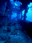
 One of the reasons the wrecks are so well preserved in Chuuk Lagoon is because the atoll protects them from strong ocean currents. The lagoon inside of the atoll is also shallow (compared to the ocean), not much more than 120 feet in most places. Since you can't scuba dive any deeper than 130 feet for safety reasons, this makes the lagoon an ideal place for scuba diving.
Remember, Karen and I need your help with making our adventure a success! Start sending us questions to ask the high school students about life and being a teenager on a small, tropical island. For an example, one of my questions is going to be about the kind of stuff they have that may be similar or different than American students: "Do you have a television, CD player, computer and a VCR?" I also want to ask them what they do with their free time - if they have any.
Also, don't forget that we will be having live chats during the trip - a great time for giving us ideas and suggestions as well as learning about Micronesia.
Tom


